Pacific Crest Trail: California, Oregon and Washington, 2,663 miles
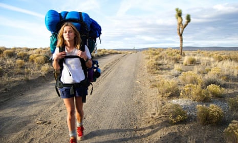
When Cheryl Strayed, writer of the memoir and new film Wild set foot on the Pacific Crest Trail (PCT) in southern California, heading north towards Oregon, she had never backpacked a day in her life. By the time she reached the border of Oregon and Washington, more than 1,000 miles later, she was a new woman, having shed blood, sweat, tears and toenails along the way. Hiking the entire PCT takes between four and six months. The trail can also be followed on horseback, and there’s a Pacific Crest Bicycle Trail that roughly parallels the PCT. Strayed successfully winged her trip with very little planning or experience, but the Pacific Crest Trail Association estimates that most hikers spend between six and eight months preparing for their trek; fewer than 200 people a year complete the entire journey from the Mexican to the Canadian border.
Top tip You don’t have to hike the whole trail to recreate the emotional end of Strayed’s journey at the Bridge of the Gods – an impressive cantilevered steel span that crosses the Columbia river between Oregon and Washington. Pedestrians crossing the bridge are supposed to pay a 50-cent toll, but long-distance hikers are often waved through, free of charge.
pcta.org
John Muir Trail: California, 210 miles
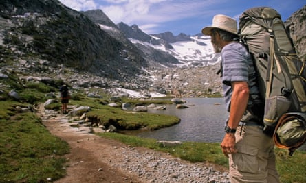
Running south through the High Sierras from Yosemite national park to the summit of Mount Whitney, the John Muir Trail is a footpath fit for a wilderness king. Muir spent his life advocating the preservation of wild places, and his eponymous trail runs along the crest of some of the most beautiful and pristine country in the US. Most hikers travel north to south in late summer and complete the trek in about three weeks. Other than the John Muir Hut on top of Muir Pass – around the midway point of the trail – there are no shelters along the route so a tent is essential. Hikers can stock up on food in a handful of small towns and remote resorts in the northern stretch of the trail, but a 100-mile wilderness section in the south requires fastidious meal planning – fitting 10-plus days’ worth of food into a bear-proof canister.
Top tip At 14,505ft (4,421m), Mount Whitney is the highest mountain in the lower 48 states. If you want to tackle the summit, you’ll probably find that having spent three weeks hiking along a trail that never dips below 7,000ft (2,000m) and crosses numerous 11,000ft-plus (3,000m-plus) passes, should see you acclimatised enough to give it a go.
johnmuirtrail.org, pcta.org
Continental Divide Trail: New Mexico, Colorado, Wyoming, Idaho and Montana, 3,100 miles
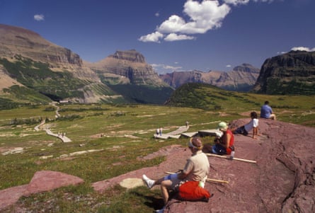
Completing the Continental Divide Trail (CDT) should gain you a doctorate in long-distance trekking logistics. Much of the route follows the remote and rugged crest of the Rocky Mountains: waters on the west of the divide drain to the Pacific and those on the east flow to the Atlantic. There are few resupply points and only 70% of the path is completed and signposted, so route finding is a significant challenge. About two dozen people a year attempt to hike the entire CDT, with a mere handful successfully completing the journey. On average, the trek takes about six months, with significant risk from deep snow and summer lightning.
Top tip The CDT passes through dramatic mountain scenery in five states, but the highlight is probably the Bob Marshall Wilderness in northern Montana. One of the largest wildernesses in the continental US, the “Bob”, as it’s nicknamed, is home to abundant wildlife. Meeting a grizzly bear is also a possibility in some regions of Wyoming, Idaho and Montana. Carry bear spray on your hip belt and avoid surprising a bear by making plenty of noise as you hike. Bears usually want to avoid people as much as people want to avoid them.
continentaldividetrail.org, cdtsociety.org
Appalachian Trail: 14 states from Georgia to Maine, 2,185 miles
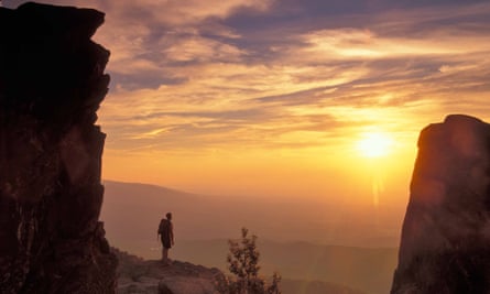
Although it’s not the oldest or the longest US long-distance footpath, the Appalachian Trail is regarded as the granddaddy of them all, in part because it’s the most user-friendly. The trail passes through and near numerous towns and crosses plenty of roads, so planning a trip on it is generally less complicated than either the PCT or the CDT. Many trail towns and businesses along the way cater for hikers, with hostels, shuttle services and restaurants running hiker specials. Navigation is easy too: the entire trail is marked by white blazes: 2x6in rectangles painted on trees, fence posts, bridge pylons and, occasionally, sidewalks. There are more than 250 three-sided sleeping shelters spaced about a day’s walk from one another, which saves hikers the weight of a tent and provides a community feel to the trail.
Top tip The most logistically challenging section is its northernmost stretch, the Hundred-Mile Wilderness in Maine. Northbound hikers must stock up in the tiny town of Monson before trekking onwards towards the northern terminus of the trail on the summit of Mount Katahdin in Baxter state park.
appalachiantrail.org, nps.gov
The Long Trail: Vermont, 272 miles
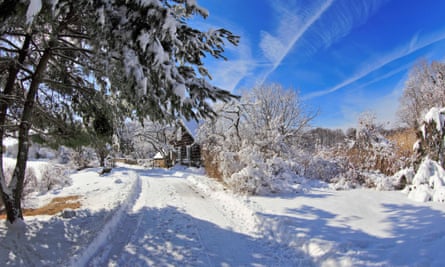
This the oldest long-distance trail in the US. Completed in 1930 by the Green Mountain Club, it runs from the Massachusetts state line in the south to the Canadian border, following the crest of the Green Mountains and hitting all the state’s major high points, including Camel’s Hump and Mount Mansfield. As with the Appalachian Trail, the Long Trail welcomes hikers with a series of shelters, usually about a day’s walk from each other. The northern stretches are generally quieter and more remote than much of the Appalachian Trail, offering Long Trail hikers plenty of solitude, a rare find on the east coast. Most hikers take a month to complete the trek.
Top tip Biting black flies can be a pain in the spring. Save your hike for late September or early October to catch prime leaf-changing season in New England.
sectionhiker.com/the-long-trail, greenmountainclub.org
The Hayduke Trail: Arizona and Utah, 812 miles
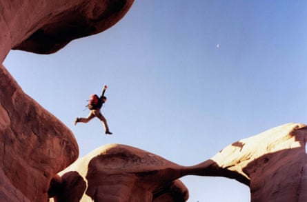
Named for one of the heroic characters in Edward Abbey’s acclaimed novel The Monkey Wrench Gang, the Hayduke Trail runs through the stunningly strange south-west desert landscape that inspired the book. Beginning in Arches national park, where Abbey worked as a ranger for three seasons, it follows a patchwork of public lands through the Canyonlands, Bryce Canyon, Grand Canyon and Zion national parks. The Hayduke Trail is not for amateurs: water is scarce along the way and route-finding skills are essential to navigating in the often-bizarre canyon country landscape. To date, fewer than 10 people have successfully hiked the entire trail, though certain sections are famously popular with weekend backpackers and day hikers.
Top tip Follow in the footsteps of hardy Mormon pioneers along the Burr Trail and the Hole-in-the-Rock road in southern Utah. This section of the Hayduke Trail passes through Capitol Reef national park and ends at the heart-stopping fissure in the canyon side down which the pioneers lowered their wagons to the Colorado River.
hayduketrail.org
The Grand Enchantment Trail: Arizona and New Mexico, 770 miles
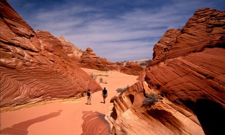
Don’t let its terminals in Phoenix and Albuquerque – two of the largest cities in the south-west – lull you into thinking this trail is in any way urban; between the two metropolises lies some of the wildest country in the US. As the crow flies, the two cities are only about 300 miles apart, but the Grand Enchantment route follows a circuitous path in order to provide hikers with ample water sources. Stitched together in 2003, using an existing network of dirt roads and trails, the footpath passes through wildly varied landscapes, from painted deserts to mountainous ridge lines and towering ponderosa pine forests. Spring is the best season to attempt the hike, which can take around three months, as water sources are highest during the spring snow melt.
Top tip Get a taste of history at the Gila Cliff Dwellings national monument in southern New Mexico. The “monument” is actually a village made by the Pueblo people of tiny stone houses tucked into natural alcoves in a cliff face. The village can be visited, but no, you can’t stay in them!
simblissity.net/get, throughhikers.com
The Ozark Highlands Trail: Arkansas, 218 miles
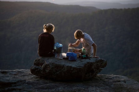
Middle America often gets overlooked for adventures, but there are many scenic miles between the Appalachians in the east and the Rockies in the west. The Ozark mountains in Arkansas are the largest range in the midwest and the Ozark Highlands Trail traverses their rolling length for over 200 miles. Unlike the more mountainous PCT and CDT, which are usually buried under snow except in late summer, the Ozark Highlands trail can be hiked all year round. There are no shelters, but the route passes through a number of campgrounds and state parks, some of which even offer showers. Be sure to bring a copy of Where the Red Fern Grows, a classic coming-of-age tale of a boy exploring the Ozarks with a loyal pair of redbone coonhounds.
Top tip The Ozarks Highlands Trail follows the scenic White river through the Lower Buffalo Wilderness for 15 miles, giving hikers a taste of true midwest wilderness.
ozarkhighlandstrail.com, ouachitamaps.com
The Ice Age Trail: Wisconsin, 1,200 miles
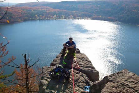
During the ice age, the region now known as Wisconsin was buried under thousands of feet of ice. As the ice retreated, it left behind a landscape strewn with post-glacial features such as potholes, kettles, boulders and lakes. Hikers can follow in the footsteps of woolly mammoths on the Ice Age Trail, which traces the former edge of the glacier for over 1,000 miles through the state of Wisconsin. The trail links numerous state parks and wilderness areas, though only about half the trail is on footpaths, marked by yellow blazes. The rest of the unfinished route follows mostly quiet country roads and is safely navigable on foot. Only a handful of people hike the entire trail each year and the Ice Age Trail Alliance recognises these “thousand-milers” on its website.
Top tip The section along the Milwaukee river follows the original 34 miles first mapped out for the trail across a unique post-glacial landscape renowned among geologists. A number of overnight shelters and walk-in campsites are available.
iceagetrail.org, nps.gov, dnr.wi.gov
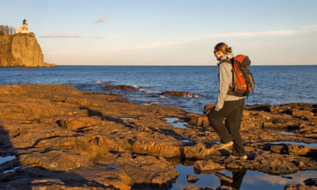
The Superior Hiking Trail: Minnesota, 296 miles
Comments (…)
Sign in or create your Guardian account to join the discussion